
Köppen-Geiger
Global 1‑km climate classification maps
Overview
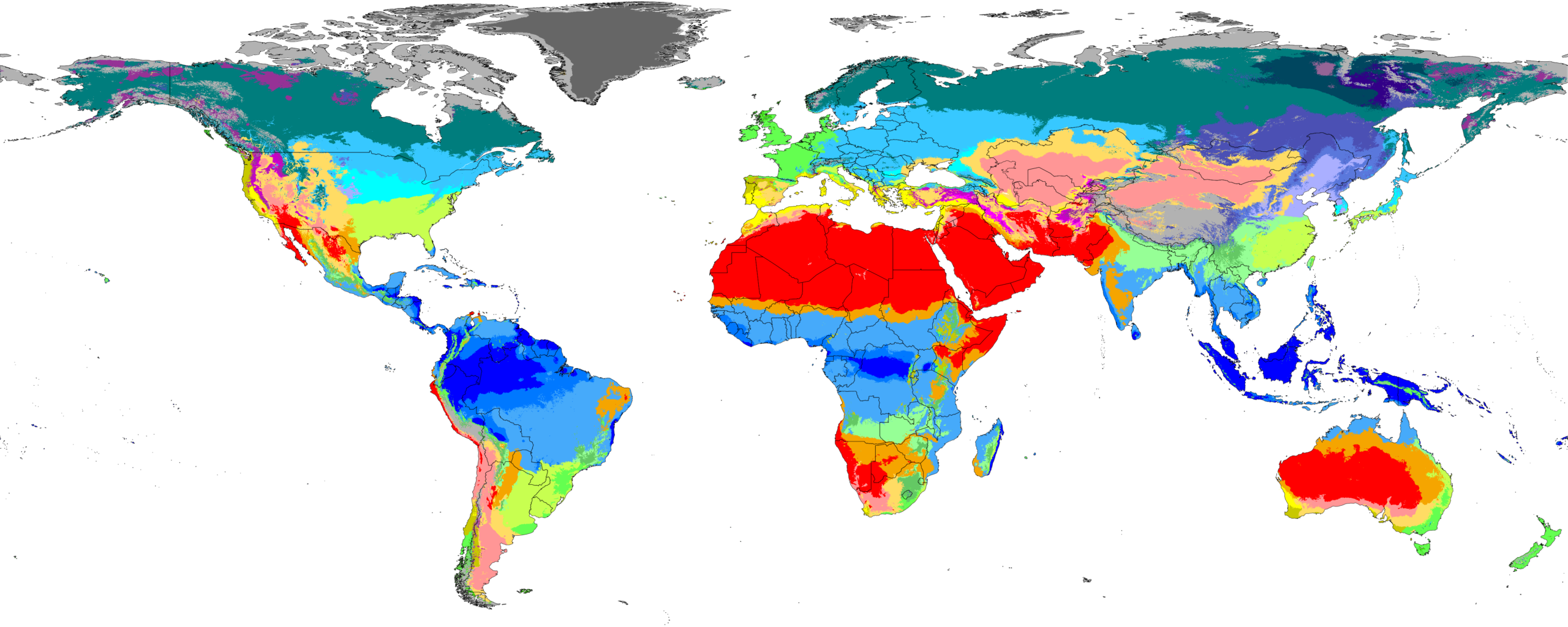
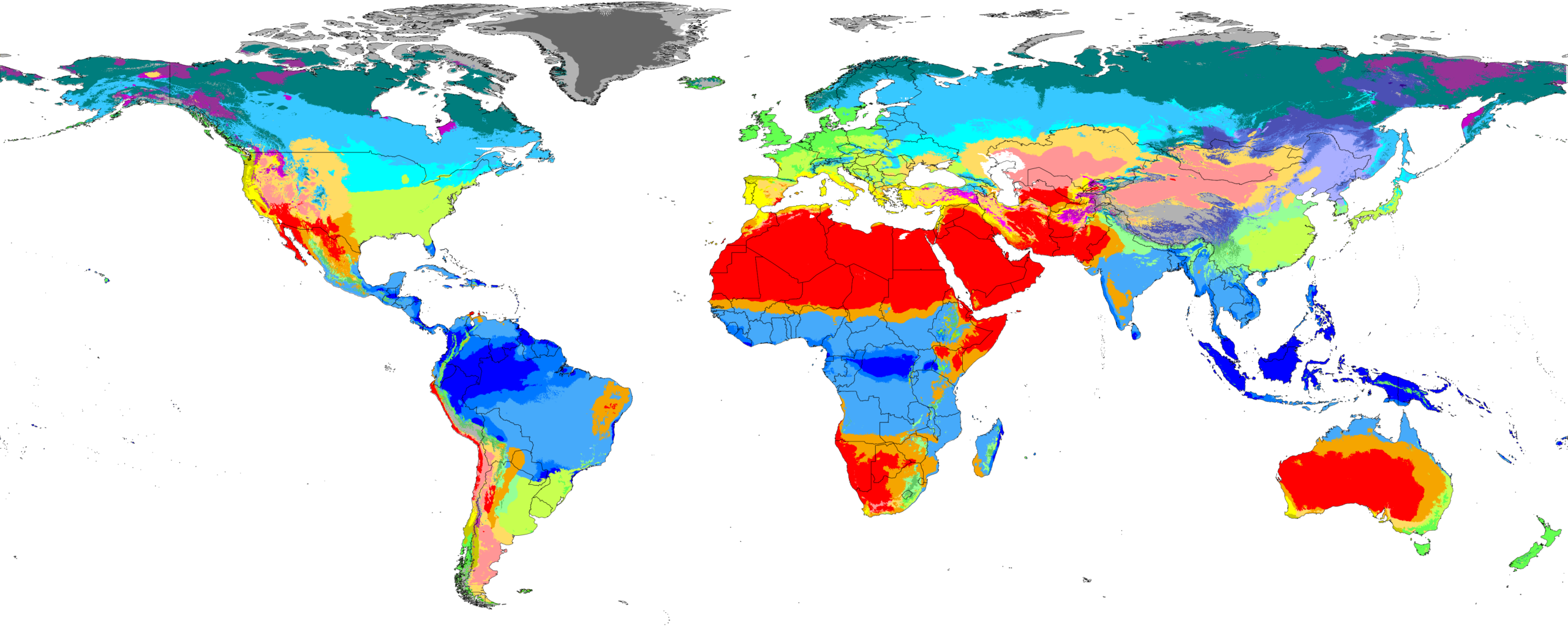
We present new global maps of the Köppen-Geiger climate classification at a high 1‑km resolution for historical and future climate conditions (1901–2099).
The historical maps (encompassing 1901–1930, 1931–1960, 1961–1990, and 1991–2020) are based on high-resolution, observation-based climatologies. The future maps (encompassing 2041–2070 and 2071–2099) are based on downscaled and bias-corrected climate projections from the Coupled Model Intercomparison Project phase 6 (CMIP6) and cover seven Shared Socio-economic Pathways (SSPs). We evaluated 67 climate models and selected 42 with the most plausible CO2-induced warming rates to derive the future maps.

Download
The latest version (V2) of the maps can be downloaded here. IMPORTANT: This archive includes GeoTIFFs of Köppen-Geiger maps in varying resolutions for multiple periods and future socio-economic scenarios. For example, the file “2071_2099\ssp585\koppen_geiger_0p01.tif” in the archive provides the Köppen-Geiger map for the period 2071–2099 under the SSP5‑8.5 scenario with a resolution of 0.01° (roughly 1 km). The archive also includes a legend file, legend.txt, which links the numeric values in the maps to the Köppen-Geiger climate symbols and provides the color scheme for displaying the maps.
Please cite the following paper when using the maps in any publication:
- Beck, H.E., T.R. McVicar, N. Vergopolan, A. Berg, N.J. Lutsko, A. Dufour, Z. Zeng, X. Jiang, A.I.J.M. van Dijk, D.G. MirallesHigh-resolution (1 km) Köppen-Geiger maps for 1901–2099 based on constrained CMIP6 projectionsScientific Data 10, 724, doi:10.1038/s41597-023–02549‑6 (2023)
The Köppen-Geiger classifcation maps, associated confidence maps, and underpinning
monthly near-surface air temperature and precipitation climatologies in netCDF format can all be downloaded here.
The data and code are released under the CC BY 4.0 license. The maps can be visualized and analyzed using most Geographic Information Systems (GIS) packages, including QGIS, ArcGIS, and GRASS. The previous version (V1) of the maps described in Beck et al. (2018) can be downloaded here.
Explore the new Köppen-Geiger maps without the need for downloads using our web app.
